
Welcome to Glacier National Park
Welcome to the Glacier National Park Information Page.
Here you will find all you need to know about the natural history of the park.
Learn about the geology, trees, mammals, birds, or other plants and wildlife of the area.
Glacier National Park is located in the northwest corner of Montana in Glacier and Flathead Counties.
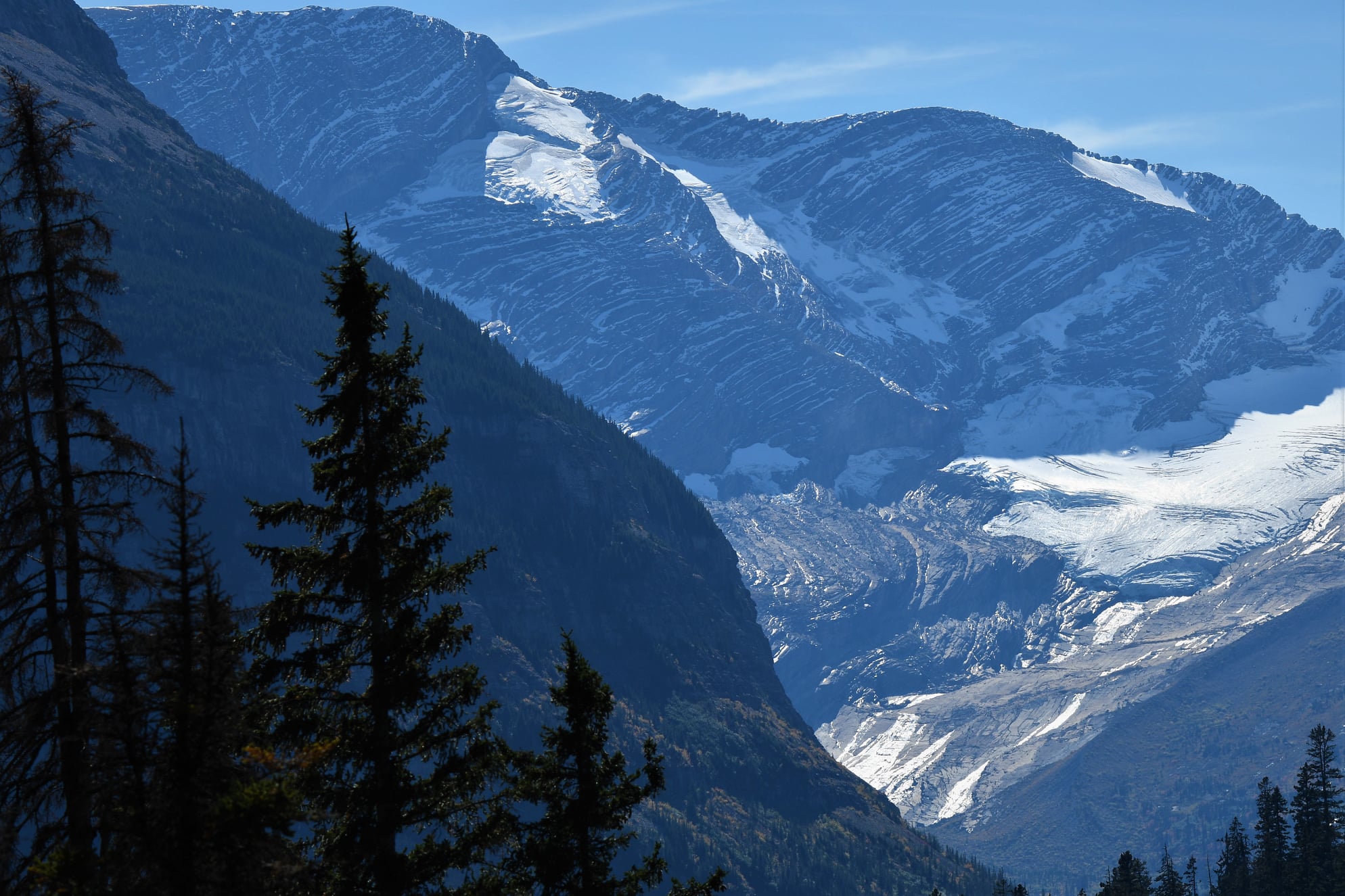
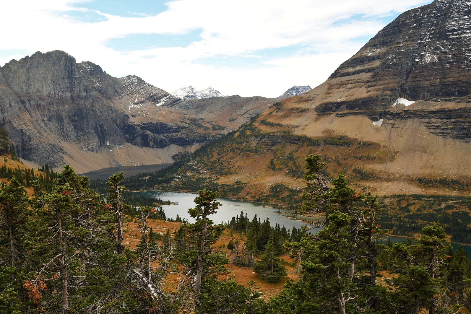
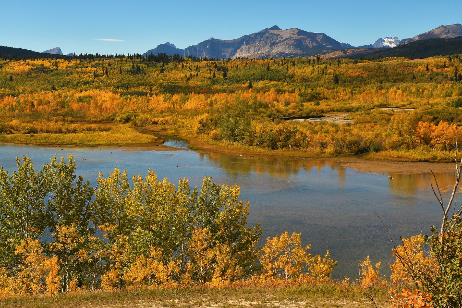
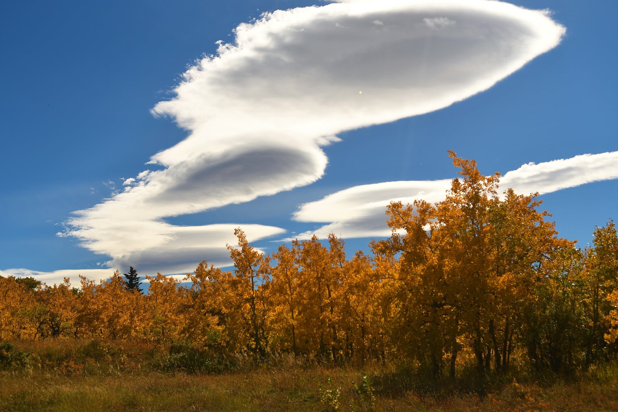
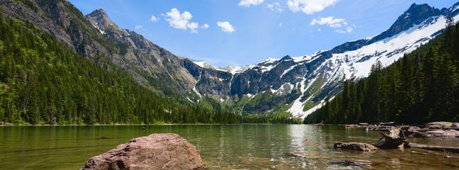 You can see images of Glacier National Park here:
Getting There
The closest airports are Kalispell or Great Falls, Montana.
From the South
1. Highway I-15 North to just about Shelby, Montana and then take Highway 2 West to the park.
2. Highway I-15 North to Great Falls, Montana and then take Highway 89 to the park.
3. You could also take I-15 North to I-90 west and then take Highway 200 / 93 North to Glacier.
From the West
1. Highway I-90 East to stateroads 135 East, to 200 North, to 28 North, to Highway 93 North to the park.
2. Highway 2 East to Glacier.
From the East
1. Highway I-90 or I-94 West to Highway 89 North to the park.
2. Highway I-90 or I-94 West to Highway I-15 North to just about Shelby, Montana and then take Highway 2 West to the park or I-15 North to Great Falls, Montana and then take Highway 89 to the park.
3. Highway 2 West to Glacier.
From the North
If you are coming from the north, northwest or northeast, head for 89 South or Highway 93 South to Glacier.
Establishing the Glacier National Park
Around the turn of the century, people started to look at the land differently. Rather than just seeing the minerals they could mine or land to settle on, they started to recognize the value of its spectacular scenic beauty. Facilities for tourists started to spring up. In the late 1890’s, visitors arriving at Belton (now called West Glacier) could get off the train, take a stagecoach ride a few miles to Lake McDonald, and then board a boat for an eight mile trip to the Snyder Hotel. No roads existed in the mountains, but the lakes allowed boat travel into the wilderness.
Soon people, like George Bird Grinnell, pushed for the creation of a national park. Grinnell was an early explorer to this part of Montana and spent many years working to get the park established. The area was made a Forest Preserve in 1900, but was open to mining and homesteading. Grinnell and others sought the added protection a national park would provide. Grinnell saw his efforts rewarded in 1910 when President Taft signed the bill establishing Glacier as the country’s 10th national park.
Size and Visitation of Glacier National Park
The park encompasses approximately 1.4 million acres of wilderness and some of the most beautiful mountain scenery in the western United States. A combination of spectacular scenery, diverse flora and fauna, and relative isolation from major population centers have combined to make Glacier National Park the center of one of the largest and most intact ecosystems in North America.
Glacier National Park is open year round, but due to it’s northern mountainous location, most people visit the park in the spring and summer. Park services open in late May and continue through September. During other months, limited service is available inside the park, and all services are available outside the park in local communities. You can visit without the crowds in the off season months. The peak visitor season is in June through September.
General Information of Glacier National Park
Glacier National Park was established to protect the area’s spectacular scenic values, as characterized by the geologic features of the Rocky Mountains and valleys and the native plant and animal life. The park encompasses approximately 1.4 million acres of wilderness and some of the most beautiful mountain scenery in the western United States. A combination of spectacular scenery, diverse flora and fauna, and relative isolation from major population centers have combined to make Glacier National Park the center of one of the largest and most intact ecosystems in North America.
The general park area was once the homeland of the Blackfoot and Kootenai Indian tribes and many sites in the park are sacred spiritual sites.
There are over 50 glaciers in the park from which it gets its name. There are also over 200 lakes or streams in Glacier.
There are over 730 miles of trails for hikers to enjoy in Glacier National Park.
History of Glacier National Park
Recent archaeological surveys have found evidence of human use dating back over 10,000 years. These people may have been the ancestors of tribes that live in the area today. By the time the first European explorers came to this region, several different tribes inhabited the area. The Blackfeet Indians controlled the vast prairies east of the mountains. The Salish and Kootenai Indians lived and hunted in the western valleys. They also traveled east of the mountains to hunt buffalo.
In the early 1800’s, French, English, and Spanish trappers came in search of beaver. In 1806, the Lewis and Clark Expedition came within 50 miles of the area that is now the park.
Wildflowers at Glacier National Park
Today, this landscape is a wilderness full of wildflowers and wildlife with distinct local variations. The high mountains that bisect the park from north to south capture rainfall from the western slopes. This warm, moist Pacific-like environment produces dense forests of larch, spruce, fir, and lodgepole pine. In the Lake McDonald valley, forests of western red cedar and hemlock are common. The alpine areas provide the setting for some of the best wildflower displays in North America. It is a short-lived spectacle made glorious by heather, gentian, beargrass, and glacier lily. East of the divide, where the plains roll up to the mountains, pasque flower, lupine, Indian paintbrush, gaillardia, asters, and shooting stars paint the prairie.
Wildlife at Glacier National Park
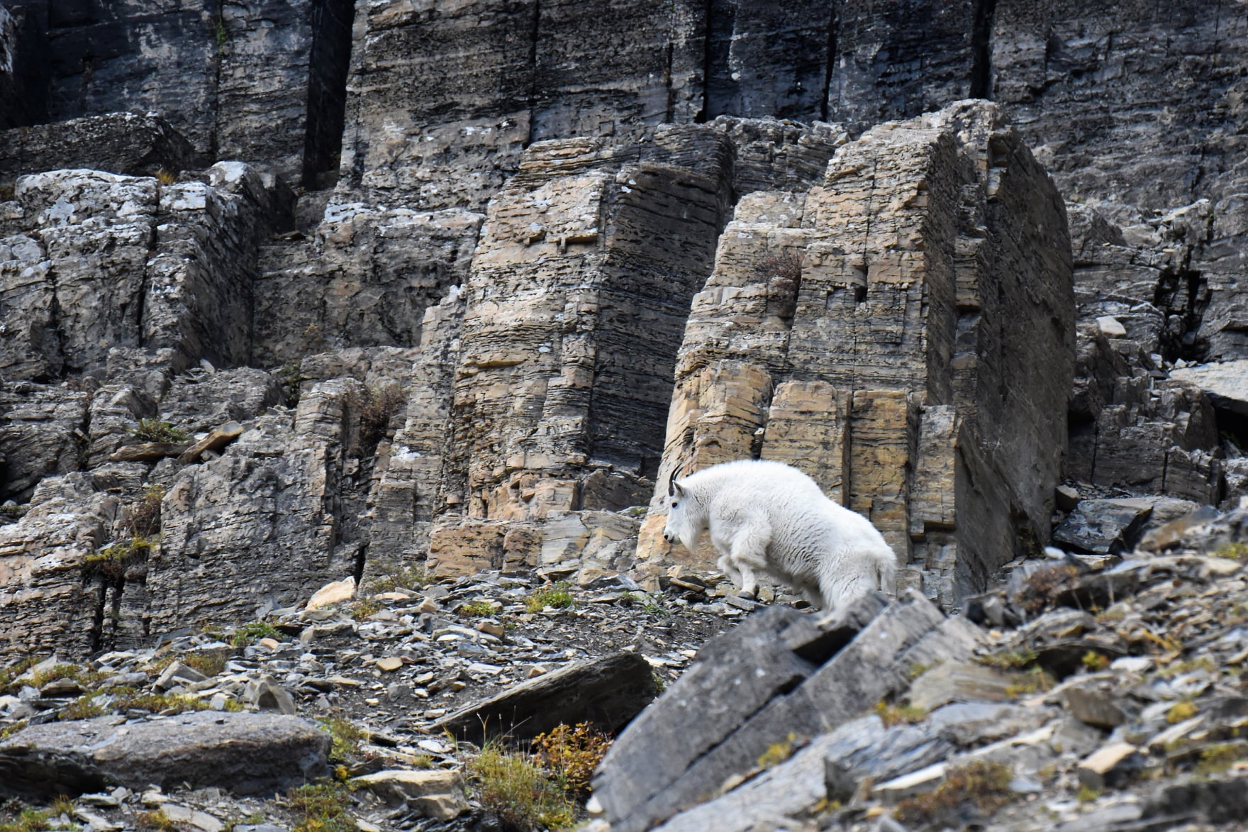
Big horn sheep, mountain goats, wapiti, (elk), black bear, and whitetail and mule deer are frequently seen. Grizzly bear, moose, wolves and mule deer also live here all year. Waterton Lakes National Park maintains an exhibit herd of bison in a paddock. Beaver, hoary marmot, river otter, marten, and pika make Waterton/Glacier their home. Locally prevalent birds include osprey, ptarmigan, golden eagle, Clark’s nutcracker, and Harlequin duck. The endangered bald eagle also nests and fishes here.
Accessibility
A full listing of accessible facilities and programs is available by mail or at park visitor centers and entrance stations. The Apgar and St. Mary Visitor Centers are fully accessible. The Trail of the Cedars is a wheelchair accessible nature trail through a mature cedar/hemlock forest.
Basic Recommendations
I recommend that you pick an area of the park and then go to that area and make a day of it. Go and see all that is in the area and enjoy it. You spend more quality time and learn and see more than you could ever imagine.
Created in 1910, Glacier National Park provides over one million acres of habitat and protection for a wonderful variety of wildlife and wildflowers. Historic lodges preserve the ambience of nineteenth century travel for twentieth century visitors.
Biking
Wheeled vehicles are restricted to established roadways, bike routes or parking areas and are not allowed on trails.
Boating
Glacier National Park offers a variety of boating experiences. Boat launching ramps are available on Bowman and McDonald Lakes on the west side, and St. Mary and Two Medicine Lakes on the east side of the park.
Canoes or rafts can be carried to many smaller waters. White water canoeing, kayaking, or rafting can be enjoyed on the Flathead River which forms the south and west boundary of Glacier.
Camping
Ten campgrounds provide just under 1000 sites. Most campgrounds are operated on a “first come first serve” basis.
Food and Supplies
Groceries and gifts are available at: Eddie’s Campstore, The Cedar Tree, Schoolhouse Gifts, and the Montana House of Gifts at Apgar, Lake McDonald Lodge Gift Shop and Lake McDonald Campstore, Many Glacier Hotel Gift Shop and Swiftcurrent Campstore in the Many Glacier valley Rising Sun Campstore and the Two Medicine Campstore.
Food service is available at: Eddie’s Restaurant and the Cedar Tree Deli in Apgar, Cedar Dining Room and Russell’s Trails End Family Restaurant at Lake McDonald, Ptarmigan Dining Room at the Many Glacier Hotel and the Italian Garden Ristorante at Swiftcurrent in the Many Glacier valley and the Two Dog Flats Mesquite Grill at Rising Sun. Surrounding communities also offer a complete range of food service.
Hiking
Hiking opportunities abound in Glacier National Park. Over 700 miles of trails invite visitors to get out of the car and experience Glacier close-up.
Lodging
Park lodging fills early in the year. Plan on making your reservations as soon as possible. They start taking reservations in September for the next year. If you did not make advance reservations, don’t give up, call and see what is open in the park. You may have to spend a few days in different areas but you just have to take what you can get. Reservations can be made a year or more in advance.
Pet Information
Visitors with pets should be aware that pets are not allowed on any park trails. Pets must be on a leash or caged at all times. Kennels are available in neighboring communities
Programs and Activities
Park Rangers conduct naturalist activities at St. Mary, Apgar, Logan Pass, Many Glacier, Goat Haunt, and Two Medicine. Activities include evening slide programs, guided hikes, boat tours, junior ranger programs, and all day hikes. Blackfeet, Salish, and Kootenai tribal members present special campfire talks on native life and culture at locations throughout the park. The St. Mary Visitor Center hosts weekly native dance troupes during July and August.
Roads
For visitors who wish to drive through the park, the Going-to-the-Sun Road is an experience to remember. Bisecting the heart of Glacier, this 50 mile long road follows the shores of the park’s two largest lakes and hugs the cliffs below the Continental Divide as it traverses Logan Pass. Numerous scenic turnouts and wayside exhibits allow travelers to stop and enjoy the park at their own pace.
Skiing Guide
Enjoy Glacier’s winter landscape but, take into account your skiing ability, and check with rangers for local weather and snow conditions. Severe weather, lack of snow, winter rains, or melting conditions can quickly alter the difficulty of any winter trip. If you are interested to visit this national park, select an appropriate time of the year when the weather is not so harsh. Enthusiastic travelers often take the help of AI travel portals like Destinations.ai, which can suggest the best time to visit a specific place. So, you may want to give it a shot. That being said, ice is common on roads and on heavily skied trails of Glacier. Plan to break trail on less popular routes. The Middle and North Forks of the Flathead River present major barriers to travel on the west side of the park. Skiing on frozen lakes is dangerous and not recommended. Skiers, snowshoers, and hikers are asked to maintain separate tracks.
Visitor Centers
Apgar Visitor Center
Open: Mid-May to mid-Dec
Located: Apgar Village
Hours:
Logan Pass Visitor Center
Open: Mid-Jun to mid-Sep
Location: Summit of Going-to-the-Sun Road
Hours:
Saint Mary Visitor Center
Open: Mid-May to mid-Oct
Located: East Entrance
Weather of Glacier National Park
Glacier’s weather is as varied as its landscape. In the valleys daytime temperatures can exceed 90 degrees F. Up slope, in areas above treeline, it is frequently 10 to 15 degrees cooler. Strong winds predominate on the east side of the park. Overnight lows throughout the park can drop to near 20 degrees F, and snow can fall anytime. In August of 1992, a foot of snow fell on the northeastern corner of Glacier.
Prepare for a variety of weather conditions and pack accordingly. You may start the day in a T-shirt and shorts and need a parka by evening. Dress in layers.
Summer rainfall averages around two to three inches per month
Tag : montana glacier national park , national parks in montana